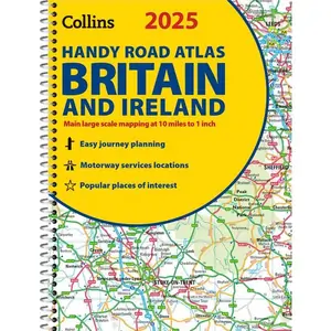
Waterstones 2024 Collins Handy Road Atlas Britain and Ireland

TO EXPLORE MORE
Price: £5.99
Brand: Waterstones
Description: This easy-to-use, handy A5 sized road atlas with popular lie-flat spiral binding features extremely clear route planning maps of Britain and Ireland and fits neatly into your glove box or bag. The maps of Britain are at 10 miles to 1 inch (1:625,000) and the whole of Ireland is covered at 15.8 miles to 1 inch (1:1,000,000). There are also a selection of more detailed urban area maps at 4.5 miles to 1 inch (1:285,000) to aid route planning in these busy areas. Main features: Road maps that focus on the main roads, motorways and settlements More detailed maps of London, Manchester, Merseyside and West Midlands Park & Ride locations (for bus and rail) Handy distance calculator chart highlighting distances between the major towns. Waterstones 2024 Collins Handy Road Atlas Britain and Ireland - shop the best deal online on thebookbug.co.uk
Category: Books
Merchant: Waterstones
Product ID: 9780008597610
Delivery cost: 2.99
ISBN: 9780008597610

My website utilises affiliate links when you click my 'Get the best deal now' buttons. If you buy something through one of these links, I may earn a little commission, at no extra cost to you.
I have relationships with many of the top online retailers (purchasing, shipping and returns will be handled directly by them) which enables me to offer the best deal online for the Waterstones 2024 Collins Handy Road Atlas Britain and Ireland and many other similar products - which will appear below, to enhance your online shopping experience.
For even more great deals on Waterstones Books, click the link.