Waterstones Atlas & Jigsaw Great Britain & Ireland

Waterstones Atlas & Jigsaw Great Britain & Ireland
Zoom
 
SCROLL DOWN
TO EXPLORE MORE
 

Price: £12.99

Brand: Waterstones


Description: Take a tour of the British Isles with this entertaining atlas and 300-piece jigsaw, with hundreds of animals, landmarks and attractions to spot. The sturdy box contains a vividly illustrated jigsaw of a map of Britain and Ireland, plus a picture atlas showing each region with towns and cities, rivers, flags and other details. (The Picture Atlas of Great Britain and Ireland is also available separately.). Waterstones Atlas & Jigsaw Great Britain & Ireland - shop the best deal online on thebookbug.co.uk


Category: Books

Merchant: Waterstones

Product ID: 9781805318927

Delivery cost: 2.99

ISBN: 9781805318927

 
Waterstones logo
 

My website utilises affiliate links when you click my 'Get the best deal now' buttons. If you buy something through one of these links, I may earn a little commission, at no extra cost to you.


I have relationships with many of the top online retailers (purchasing, shipping and returns will be handled directly by them) which enables me to offer the best deal online for the Waterstones Atlas & Jigsaw Great Britain & Ireland and many other similar products - which will appear below, to enhance your online shopping experience.


For even more great deals on Waterstones Books, click the link.


Similar Products

  • Waterstones Usborne Illustrated Atlas of Britain and Ireland

    Price: £14.99

    Brand: Waterstones


    Description: Turn the pages of this fascinating atlas to take a tour of Britain and Ireland - from the craggy far north of Scotland, to the west coast of Ireland and green fields in the south east of England. Full of famous landmarks, native wildlife, culture and history, plus website links for video tours and more information. Waterstones Usborne Illustrated Atlas of Britain and Ireland - shop the best deal online on thebookbug.co.uk

    Category: Books

    Delivery cost: 2.99

    ISBN: 9781474936637

     
    Waterstones logo

    Merchant: Waterstones

    Product ID: 9781474936637

     
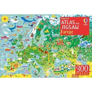
  • Waterstones Usborne Atlas and Jigsaw Europe

    Price: £9.99

    Brand: Waterstones

     
    4.7 out of 5 stars

    98 ratings


    Description: Take a tour of Europe with this entertaining picture atlas and 300-piece jigsaw, with hundreds of animals, landmarks and attractions to spot. The sturdy box contains a vividly illustrated jigsaw of a map of Europe, plus a 32-page atlas showing each country with towns and cities, rivers, flags and other details, and internet links to find out more. (The picture atlas is also available as a hardback book called Picture Atlas of Europe.). Waterstones Usborne Atlas and Jigsaw Europe - shop the best deal online on thebookbug.co.uk

    Category: Books

    Delivery cost: 2.99

    ISBN: 9781474948067

     
    Waterstones logo

    Merchant: Waterstones

    Product ID: 9781474948067

     
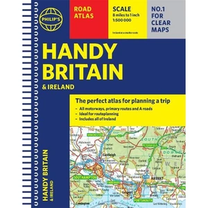
  • Waterstones Philip's Handy Road Atlas Britain

    Price: £5.99

    Brand: Waterstones


    Description: The perfect atlas for planning a trip anywhere in the UK and Ireland The essential handy road atlas for planning a trip in Britain and Ireland. Keep it in the glove box or your travel bag for quick and easy reference. This gem of a glove-box sized atlas has all the core information you need for driving around the British Isles. It includes all the motorways, primary roads and A Roads and they are clearly shown - ideal for route planning. There is a separate 4-page road map of Ireland for easy use. Alongside that, this handy atlas includes a key map, a distance table and useful counties map. All the towns and villages listed within are indexed and all the information comes in a handy glove-box size format with practical, lie-flat spiral binding. With the scale at a user-friendly 8 miles to 1 inch /1:500,000 (Ireland 19 miles to 1 inch /1:1,200,000) and fully up-to-date using Philip's clear mapping, you will never be at a loss to establish the best route. Keep in the car or sling in your bag before travelling, the Philip's Handy Road Atlas of Britain is also great value at only £5.99. Waterstones Philip's Handy Road Atlas Britain - shop the best deal online on thebookbug.co.uk

    Category: Books

    Delivery cost: 2.99

    ISBN: 9781849075770

     
    Waterstones logo

    Merchant: Waterstones

    Product ID: 9781849075770

     
  • Geographers' A-Z Map Co Ltd Great Britain & Northern Ireland A-Z Road Atlas 2025 (A3 Paperback), Sports, Hobbies & Travel, Paperback, A-Z Maps

    Price: £12.99

    Brand: Geographers' A-Z Map Co Ltd


    Description: Navigate your way around Great Britain with this detailed and easy-to-use A-Z Road Atlas. Geographers' A-Z Map Co Ltd Great Britain & Northern Ireland A-Z Road Atlas 2025 (A3 Paperback), Sports, Hobbies & Travel, Paperback, A-Z Maps - shop the best deal online on thebookbug.co.uk

    Category: Books

    Delivery cost: Spend £20 and get free shipping

    Dimensions: 280x390mm

    Keywords: road atlas,google maps,atlas,route map,a to z maps,maps,street map,route planner uk,street finder,Sat Nav,GPS,aa maps,road map uk,satellite navigation,great britain,super scale,easy-to-read,big easy read,clear mapping,large scale,big format,large text

    ISBN: 9780008652920

     
    Harper Collins logo

    Merchant: Harper Collins

    Product ID: 9780008652920

     
  • Waterstones Rail Atlas Of Great Britain And Ireland 15th Edition

    Price: £20.00

    Brand: Waterstones

     
    4.8 out of 5 stars

    303 ratings


    Description: . Waterstones Rail Atlas Of Great Britain And Ireland 15th Edition - shop the best deal online on thebookbug.co.uk

    Category: Books

    Delivery cost: 2.99

    ISBN: 9780860936817

     
    Waterstones logo

    Merchant: Waterstones

    Product ID: 9780860936817

     
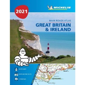
  • Lovereading Great Britain & Ireland 2021 - Mains Roads Atlas (A4-Paperback) Tourist & Motoring Atlas A4 Paperback

    Price: £7.19

    Brand: Lovereading


    Description: Great Britain & Ireland 2021 - Mains Roads Atlas (A4-Paperback) Tourist & Motoring Atlas A4 Paperback. Paperback /softback.

    Category: Books

     
    LoveReading logo

    Merchant: LoveReading

    Product ID: 9782067244436

     
  • Lovereading Great Britain & Ireland 2023 - Mains Roads Atlas (A4-Spiral)

    Price: £10.79

    Brand: Lovereading


    Description: Great Britain & Ireland 2023 - Mains Roads Atlas (A4-Spiral). Spiral bound. By Michelin.

    Category: Books

     
    LoveReading logo

    Merchant: LoveReading

    Product ID: 9782067254909

     
  • Waterstones Great Britain & Ireland 2024 - Mains Roads Atlas (A4-Spiral)

    Price: £11.99

    Brand: Waterstones


    Description: Updated annually - Full of practical features, the Michelin Road Atlas Great Britain & Ireland is the perfect companion for your everyday journey and holiday planning. Updated every year, it gives you clear and accurate information for a safe and enjoyable journey thanks to a detailed mapping scale of 1/300 000. The route planner as well as the time and distance charts will help you plan and optimise your journey. Michelins safety alerts warn you about dangerous driving areas, such as steep hills, level crossing as well as risk zone subject to tighter speed check. The Michelin Great Britain and Ireland road atlas also shows tourist sights, leisure facilities, as well as scenic routes so that you can make the most of your journey. Michelin Great Britain & Ireland Atlas (A4 Spiral) features:* Detailed mapping with a scale 1/300 000 (4.75 miles to 1 inch) * Mileage chart and journey times to help you plan your journey * Key to Map Pages to quickly access your region of interest* Practical street plan section for an easy navigation in urban areas: 52 town plans embedded in the mapping of their surrounding area. * Easier navigation thanks to the location map featured on top of each page. * An extensive place name index to easily identify the destination of your choice * Comprehensive and detailed key to symbols used * Fuel station and service areas * Tourist information with place of interest and leisure facilities, as well as scenic routes, cross-referenced with the famous Michelin Green Guides, with towns underlined in green. Waterstones Great Britain & Ireland 2024 - Mains Roads Atlas (A4-Spiral) - shop the best deal online on thebookbug.co.uk

    Category: Books

    Delivery cost: 2.99

    ISBN: 9782067257948

     
    Waterstones logo

    Merchant: Waterstones

    Product ID: 9782067257948

     
  • Waterstones Great Britain A-Z Handy Road Atlas 2025 (A5 Spiral)

    Price: £8.99

    Brand: Waterstones


    Description: Navigate your way around Great Britain with this detailed and easy-to-use A-Z Road Atlas A full-colour, spiral bound road atlas, now fully revised and updated. Clear detailed road mapping at a scale of 5 miles to 1 inch. Presented in a compact A5 size for ease of storage. This handy road atlas of Great Britain includes: Mileage chart Channel Tunnel terminus maps Index to cities, towns, villages, hamlets and major destinations Map reference information also in French and German Instantly recognisable and easy to use, the road mapping has been specifically tailored for the smaller scale featuring: clear standard road classification colours for easy identification, motorway junction symbols, under construction and proposed roads, primary route destinations, service areas, National and county boundaries, and a wide range of tourist and ancillary information, including Blue Flag Beaches. This A-Z Handy Road Atlas of Great Britain and Northern Ireland is the perfect choice for those wanting a compact spiral bound publication with A-Z quality road mapping. Waterstones Great Britain A-Z Handy Road Atlas 2025 (A5 Spiral) - shop the best deal online on thebookbug.co.uk

    Category: Books

    Delivery cost: 2.99

    ISBN: 9780008652937

     
    Waterstones logo

    Merchant: Waterstones

    Product ID: 9780008652937

     
  • 2024 Collins Handy Road Atlas Britain and Ireland, Sports, Hobbies & Travel, Spiral Bound, Collins Maps

    Price: £5.99

    Brand: Collins


    Description: This easy-to-use, handy A5 sized road atlas with popular lie-flat spiral binding features extremely clear route planning maps of Britain and Ireland and fits neatly into your glove box or bag. 2024 Collins Handy Road Atlas Britain and Ireland, Sports, Hobbies & Travel, Spiral Bound, Collins Maps - shop the best deal online on thebookbug.co.uk

    Category: Books

    Delivery cost: Spend £20 and get free shipping

    Dimensions: 154x210mm

    Keywords: Britain road atlas,google maps,atlas,route map,a to z maps,road trip,street map,route planner uk,ireland road atlas,Sat Nav,GPS,aa maps,staycation,british holiday,satellite navigation

    ISBN: 9780008597610

     
    Harper Collins logo

    Merchant: Harper Collins

    Product ID: 9780008597610