Waterstones Italy Road Atlas (1:150,000)

Waterstones Italy Road Atlas (1:150,000)
Zoom
 
SCROLL DOWN
TO EXPLORE MORE
 

Price: £36.90

Brand: Waterstones


Description: In addition to the clear design, the large road atlas of Italy has a lot of additional information such as road conditions, sights and various city maps. An extra chapter also deals with all campsites and parking spaces in Italy. The extensive location index also enables quick orientation. Details: Tourist information, register of places with postcodes, campsite, caravan site, city maps of Ancona, Aosta, Bari, Bologna, Bolzano, Cagliari, Campobasso, Catanzaro, Florence, Genoa, L' Aquila, Meran, Milan, Naples, Palermo, Perugia, Potenza, Rome, Turin, Trento, Trieste, Venice, Vatican, San Marino, freytag & berndt car atlases are available for many countries and regions worldwide. Waterstones Italy Road Atlas (1:150,000) - shop the best deal online on thebookbug.co.uk


Category: Books

Merchant: Waterstones

Product ID: 9783707921663

Delivery cost: 0.00

ISBN: 9783707921663

 
Waterstones logo
 

My website utilises affiliate links when you click my 'Get the best deal now' buttons. If you buy something through one of these links, I may earn a little commission, at no extra cost to you.


I have relationships with many of the top online retailers (purchasing, shipping and returns will be handled directly by them) which enables me to offer the best deal online for the Waterstones Italy Road Atlas (1:150,000) and many other similar products - which will appear below, to enhance your online shopping experience.


For even more great deals on Waterstones Books, click the link.


Similar Products

  • Geographers' A-Z Map Co Ltd Northern England A-Z Road Atlas, Sports, Hobbies & Travel, Paperback, A-Z Maps

    Price: £7.99

    Brand: Geographers' A-Z Map Co Ltd


    Description: Find your way around Northern England with this fully revised and updated road atlas. A full colour regional road atlas featuring 52 pages of road mapping. Geographers' A-Z Map Co Ltd Northern England A-Z Road Atlas, Sports, Hobbies & Travel, Paperback, A-Z Maps - shop the best deal online on thebookbug.co.uk

    Category: Books

    Delivery cost: Spend £20 and get free shipping

    Dimensions: 170x245mm

    ISBN: 9780008532192

     
    Harper Collins logo

    Merchant: Harper Collins

    Product ID: 9780008532192

     
  • Road Atlas Ireland, Sports, Hobbies & Travel, Paperback, Collins Maps

    Price: £6.99

    Brand: Collins


    Description: Explore Ireland with this accurate and fully updated road atlas. This road atlas is at A4 size, covering the whole of Ireland and features clear and detailed Collins colour mapping at a scale of 5.2 miles to 1 inch. Perfect for both residents and visitorstouring Ireland. Road Atlas Ireland, Sports, Hobbies & Travel, Paperback, Collins Maps - shop the best deal online on thebookbug.co.uk

    Category: Books

    Delivery cost: Spend £20 and get free shipping

    Dimensions: 210x297mm

    Keywords: Ireland,Irish books,city plans,Belfast map,Dublin map,Republic of Ireland ROI,Northern Ireland,Ireland Irish tourist guide,navigation,route finding,speed camera,speed enforcement zone,Bestselling Ireland road map,OS Ireland,Fold out map Ireland

    ISBN: 9780008597672

     
    Harper Collins logo

    Merchant: Harper Collins

    Product ID: 9780008597672

     
  • Waterstones France - Mini Atlas

    Price: £5.99

    Brand: Waterstones


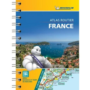
    Description: Small and practical, France mini-road atlas is a must have in your car's glove compartment. This pocket sized atlas will give you an overall view of your journey thanks to its scale 1/1000 000. This compact atlas is very convenient to use thanks to its pocket sized format, a complete index of localities and a very clever distance and time chart Small and practical. France mini-road atlas features:* Scale: 1/1,000,000* Key to map page* Distance table* Exhaustive town index* Primary and secondary road network* Indication of tourist sights and scenic routes. Waterstones France - Mini Atlas - shop the best deal online on thebookbug.co.uk

    Category: Books

    Delivery cost: 2.99

    ISBN: 9782067235939

     
    Waterstones logo

    Merchant: Waterstones

    Product ID: 9782067235939

     
  • Geographers' A-Z Map Co Ltd Wales A-Z Road Atlas, Sports, Hobbies & Travel, Paperback, A-Z Maps

    Price: £7.99

    Brand: Geographers' A-Z Map Co Ltd


    Description: Full-colour road atlas of Wales, with extended coverage into England and including all the major routes into the country. The detailed road mapping also includes Liverpool, Warrington, Nantwich, Shrewsbury, Hereford, Bristol and Severn River Crossings. Geographers' A-Z Map Co Ltd Wales A-Z Road Atlas, Sports, Hobbies & Travel, Paperback, A-Z Maps - shop the best deal online on thebookbug.co.uk

    Category: Books

    Delivery cost: Spend £20 and get free shipping

    Dimensions: 170x245mm

    Keywords: Road trip,route planner,routes and ways,wales,welsh border,cardiff,swansea,tourist information,staycation,visit wales,snowdonia,pembrokeshire,european roads,street finder,google maps

    ISBN: 9780008560553

     
    Harper Collins logo

    Merchant: Harper Collins

    Product ID: 9780008560553

     
  • Geographers' A-Z Map Co Ltd Midlands A-Z Road Atlas, Sports, Hobbies & Travel, Paperback, A-Z Maps

    Price: £7.99

    Brand: Geographers' A-Z Map Co Ltd


    Description: A full-colour, regional road atlas of the Midlands from A-Z Maps, featuring 46 pages of continuous road mapping. Geographers' A-Z Map Co Ltd Midlands A-Z Road Atlas, Sports, Hobbies & Travel, Paperback, A-Z Maps - shop the best deal online on thebookbug.co.uk

    Category: Books

    Delivery cost: Spend £20 and get free shipping

    Dimensions: 170x245mm

    Keywords: road atlas,google maps,great britain map book,route map,geographer’s a to z maps,maps,street map,route planner europe,street finder,Sat Nav satnav,road map,aa maps,road map,satellite navigation,midlands,birmingham,coventry,derby,rugby,Leicester,Loughborough,

    ISBN: 9780008652838

     
    Harper Collins logo

    Merchant: Harper Collins

    Product ID: 9780008652838

     
  • Collins Essential Road Atlas Europe, Sports, Hobbies & Travel, Paperback, Collins Maps

    Price: £14.99

    Brand: Collins


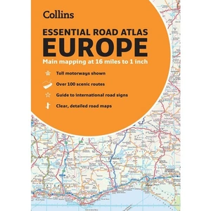
    Description: Discover new places with handy road atlases from Collins. Up-to-date A4 paperback road atlas of Europe. Contains clear, large-scale, detailed road mapping, perfect for touring the Mediterranean, Iberian peninsula, Scandinavia and all European tourist destinations. Collins Essential Road Atlas Europe, Sports, Hobbies & Travel, Paperback, Collins Maps - shop the best deal online on thebookbug.co.uk

    Category: Books

    Delivery cost: Spend £20 and get free shipping

    Dimensions: 210x297mm

    Keywords: road atlas europe,google maps,europe map book,route map,a to z maps,maps,street map,route planner europe,street finder,Sat Nav satnav,road map europe,aa maps,road map europe,satellite navigation

    ISBN: 9780008403966

     
    Harper Collins logo

    Merchant: Harper Collins

    Product ID: 9780008403966

     
  • Geographers' A-Z Map Co Ltd South West England A-Z Road Atlas, Sports, Hobbies & Travel, Paperback, A-Z Maps

    Price: £7.99

    Brand: Geographers' A-Z Map Co Ltd


    Description: This full-colour road atlas features 30 pages of continuous road mapping. Includes Cornwall, Devon, Dorset, Plymouth Somerset and Torbay. Geographers' A-Z Map Co Ltd South West England A-Z Road Atlas, Sports, Hobbies & Travel, Paperback, A-Z Maps - shop the best deal online on thebookbug.co.uk

    Category: Books

    Delivery cost: Spend £20 and get free shipping

    Dimensions: 169x238mm

    Keywords: road map,route planner,sat nav,south west england,2022,23,24,cornwall,devon,bristol,salisbury,street map,best map of england,british roads,road trips,new map britain,southern england,a-z,routes and ways

    ISBN: 9780008560577

     
    Harper Collins logo

    Merchant: Harper Collins

    Product ID: 9780008560577

     
  • Waterstones 2024 Philip's Big Easy to Read Britain Road Atlas

    Price: £14.99

    Brand: Waterstones


    Description: The detail you need at a size you can read. The latest 2024 Big Easy to Read Britain road atlas from Philip's with:- Large print maps - Huge 1:150,000 scale (approx 2.4 miles to 1 inch) - Large print place names - Large print index - Large format (nearly A3) - Super-clear 10-page routeplanner - 88 large town plans - 10 big city approach maps - Easy-to-use paperback binding At last, a Road Atlas that everyone can read easily in or out of the car, no matter what the conditions. Large scale maps, large print place names, clear road colours (which are easier to read in the dark), large print index and a special route-planning section that's almost a road atlas in itself. If it's dark, or you just can't find your glasses, the new Philip's Big Easy to Read Britain Road Atlas is the answer - wherever you're driving in England, Scotland or Wales. Waterstones 2024 Philip's Big Easy to Read Britain Road Atlas - shop the best deal online on thebookbug.co.uk

    Category: Books

    Delivery cost: 2.99

    ISBN: 9781849076258

     
    Waterstones logo

    Merchant: Waterstones

    Product ID: 9781849076258

     
  • Waterstones Philip's Handy Road Atlas Britain

    Price: £5.99

    Brand: Waterstones


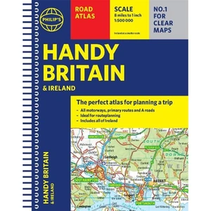
    Description: The perfect atlas for planning a trip anywhere in the UK and Ireland The essential handy road atlas for planning a trip in Britain and Ireland. Keep it in the glove box or your travel bag for quick and easy reference. This gem of a glove-box sized atlas has all the core information you need for driving around the British Isles. It includes all the motorways, primary roads and A Roads and they are clearly shown - ideal for route planning. There is a separate 4-page road map of Ireland for easy use. Alongside that, this handy atlas includes a key map, a distance table and useful counties map. All the towns and villages listed within are indexed and all the information comes in a handy glove-box size format with practical, lie-flat spiral binding. With the scale at a user-friendly 8 miles to 1 inch /1:500,000 (Ireland 19 miles to 1 inch /1:1,200,000) and fully up-to-date using Philip's clear mapping, you will never be at a loss to establish the best route. Keep in the car or sling in your bag before travelling, the Philip's Handy Road Atlas of Britain is also great value at only £5.99. Waterstones Philip's Handy Road Atlas Britain - shop the best deal online on thebookbug.co.uk

    Category: Books

    Delivery cost: 2.99

    ISBN: 9781849075770

     
    Waterstones logo

    Merchant: Waterstones

    Product ID: 9781849075770

     
  • Geographers' A-Z Map Co Ltd Southern England A-Z Road Atlas, Sports, Hobbies & Travel, Paperback, A-Z Maps

    Price: £7.99

    Brand: Geographers' A-Z Map Co Ltd


    Description: A full-colour regional road atlas featuring 39 pages of continuous road mapping. Covering an extensive area, including Bristol, Swindon, Reading, Slough, Guildford, Littlehampton, Portsmouth, Isle of Wight, Bournemouth, Cardiff, Newport, Weymouth, Sidmouth, Taunton and Weston-Super-Mare. Geographers' A-Z Map Co Ltd Southern England A-Z Road Atlas, Sports, Hobbies & Travel, Paperback, A-Z Maps - shop the best deal online on thebookbug.co.uk

    Category: Books

    Delivery cost: Spend £20 and get free shipping

    Dimensions: 170x245mm

    Keywords: road atlas,google maps,great britain map book,route map,beach holiday,south coast,street map,route planner europe,street finder,british seaside,road trip planner,aa maps,road map,staycation

    ISBN: 9780008560560

     
    Harper Collins logo

    Merchant: Harper Collins

    Product ID: 9780008560560