Waterstones 2024 Philip's Road Atlas Britain and Ireland

Waterstones 2024 Philip's Road Atlas Britain and Ireland
Zoom
 
SCROLL DOWN
TO EXPLORE MORE
 

Price: £16.99

Brand: Waterstones


Description: PHILIP'S - Market leaders and No. 1 in the UK for clear maps' Good balance between detail and clarity with excellent town maps' What Car?* Super-clear mapping at a scale of 3 miles to 1 inch = 1:200,000* Includes the latest highway code requirements* Completely updated and revised for 2024* New map showing Smart Motorways- Practical spiral bound, lie-flat format- 160 pages of fully updated super-clear road maps - 10 pages of detailed route-planning maps - plan your route in advance - 88 indexed town-centre maps - 14 pages of city approach maps with named arterial roads - 2 page road map of Ireland- Map of scenic Britain and a map highlighting railways, airports and ferry ports Philip's 2024 Road Atlas Britain and Ireland is the top-of-the-range spiral road atlas featuring the latest maps from the Philip's digital database. Voted Britain's clearest and most detailed in an independent consumer survey, the mapping is super-clear. Philip's 2024 Road Atlas Britain and Ireland contains 160 pages of road maps covering Britain at 3 miles to 1 inch, with the Western Isles, Orkney and Shetland at smaller scales. The maps clearly mark service areas, roundabouts and multi-level junctions, and in rural areas distinguish between roads over and under 4 metres wide. The atlas also includes a 2-page road map of Ireland, 10 pages of route-planning maps, a distance table, 10 large-scale city approach maps with named arterial roads, and 88 extra-detailed and fully indexed town and city plans. Waterstones 2024 Philip's Road Atlas Britain and Ireland - shop the best deal online on thebookbug.co.uk


Category: Books

Merchant: Waterstones

Product ID: 9781849076241

Delivery cost: 2.99

ISBN: 9781849076241

 
Waterstones logo
 

My website utilises affiliate links when you click my 'Get the best deal now' buttons. If you buy something through one of these links, I may earn a little commission, at no extra cost to you.


I have relationships with many of the top online retailers (purchasing, shipping and returns will be handled directly by them) which enables me to offer the best deal online for the Waterstones 2024 Philip's Road Atlas Britain and Ireland and many other similar products - which will appear below, to enhance your online shopping experience.


For even more great deals on Waterstones Books, click the link.


Similar Products

  • 2024 Collins Big Road Atlas Britain and Northern Ireland, Sports, Hobbies & Travel, Spiral Bound, Collins Maps

    Price: £14.99

    Brand: Collins


    Description: The ultimate 3.2 miles to 1 inch scale large format paperback road atlas of Britain, featuring Collins' popular and well established road mapping, and designed for exceptional clarity and ease of use. 2024 Collins Big Road Atlas Britain and Northern Ireland, Sports, Hobbies & Travel, Spiral Bound, Collins Maps - shop the best deal online on thebookbug.co.uk

    Category: Books

    Delivery cost: Spend £20 and get free shipping

    Dimensions: 295x385mm

    Keywords: road atlas,google maps,atlas,route map,a to z maps,maps,street map,route planner uk,street finder,Sat Nav,GPS,aa maps,road map uk,satellite navigation

    ISBN: 9780008597603

     
    Harper Collins logo

    Merchant: Harper Collins

    Product ID: 9780008597603

     
  • 2024 Collins Handy Road Atlas Britain and Ireland, Sports, Hobbies & Travel, Spiral Bound, Collins Maps

    Price: £5.99

    Brand: Collins


    Description: This easy-to-use, handy A5 sized road atlas with popular lie-flat spiral binding features extremely clear route planning maps of Britain and Ireland and fits neatly into your glove box or bag. 2024 Collins Handy Road Atlas Britain and Ireland, Sports, Hobbies & Travel, Spiral Bound, Collins Maps - shop the best deal online on thebookbug.co.uk

    Category: Books

    Delivery cost: Spend £20 and get free shipping

    Dimensions: 154x210mm

    Keywords: Britain road atlas,google maps,atlas,route map,a to z maps,road trip,street map,route planner uk,ireland road atlas,Sat Nav,GPS,aa maps,staycation,british holiday,satellite navigation

    ISBN: 9780008597610

     
    Harper Collins logo

    Merchant: Harper Collins

    Product ID: 9780008597610

     
  • Waterstones 2024 Collins Handy Road Atlas Britain and Ireland

    Price: £5.99

    Brand: Waterstones


    Description: This easy-to-use, handy A5 sized road atlas with popular lie-flat spiral binding features extremely clear route planning maps of Britain and Ireland and fits neatly into your glove box or bag. The maps of Britain are at 10 miles to 1 inch (1:625,000) and the whole of Ireland is covered at 15.8 miles to 1 inch (1:1,000,000). There are also a selection of more detailed urban area maps at 4.5 miles to 1 inch (1:285,000) to aid route planning in these busy areas. Main features: Road maps that focus on the main roads, motorways and settlements More detailed maps of London, Manchester, Merseyside and West Midlands Park & Ride locations (for bus and rail) Handy distance calculator chart highlighting distances between the major towns. Waterstones 2024 Collins Handy Road Atlas Britain and Ireland - shop the best deal online on thebookbug.co.uk

    Category: Books

    Delivery cost: 2.99

    ISBN: 9780008597610

     
    Waterstones logo

    Merchant: Waterstones

    Product ID: 9780008597610

     
  • 2024 Collins Essential Road Atlas Britain and Northern Ireland, Sports, Hobbies & Travel, Spiral Bound, Collins Maps

    Price: £14.99

    Brand: Collins


    Description: This A4 road atlas with lie-flat spiral binding provides clear and detailed road mapping for England, Wales and Southern Scotland at a scale of 3.2 miles to 1 inch (1:200,000). For Northern Scotland the mapping is at a scale of 4.2 miles to 1 inch (1:266,000), with land height shown by different layers of colouring. 2024 Collins Essential Road Atlas Britain and Northern Ireland, Sports, Hobbies & Travel, Spiral Bound, Collins Maps - shop the best deal online on thebookbug.co.uk

    Category: Books

    Delivery cost: Spend £20 and get free shipping

    Dimensions: 210x297mm

    Keywords: Britain road atlas,google maps,atlas,route map,a to z maps,maps,street map,route planner uk,street finder,Sat Nav,GPS,aa maps,road map uk,satellite navigation

    ISBN: 9780008597580

     
    Harper Collins logo

    Merchant: Harper Collins

    Product ID: 9780008597580

     
  • Waterstones 2024 Philip's Big Road Atlas Britain & Ireland

    Price: £15.99

    Brand: Waterstones


    Description: Philip's is No. 1 in the UK for clear maps and brings you the latest large spiral-bound format Big Road Atlas Britain and Ireland 2024 with fully updated maps from the Philip's digital database. 'Good balance between detail and clarity with excellent town maps' What Car?* Main scale of maps: 3 miles to 1 inch = 1:200,000 - all fully updated* Latest highway code information* Practical 'more to view per page' A3 lie-flat format* Smart motorways and electric cars explained* Great for planning and driving long journeys or short hops* Philip's: Britain's clearest maps for motorists* Completely updated and revised for 2024 with information on Smart Motorways and electric cars* Map of scenic Britain and a map highlighting railways, airports and ferry ports- Plan your route in advance - 6-page route-planning section - 64 fully indexed town and city plans - 16 pages of city approach maps with named arterial roads - 2-page road map of Ireland Philip's 2024 Big Road Atlas Britain and Ireland contains 96 pages of road maps covering Britain at 3 miles to 1 inch (Scottish Highlands and Western Isles at 4 miles to 1 inch, Orkney and Shetland at 5.25 miles to 1 inch). The maps clearly mark service areas, roundabouts and multi-level junctions for easy navigation, and in rural areas distinguish between roads over and under 4 metres wide - a boon for drivers of wide vehicles. The atlas also includes a 2-page road map of Ireland, route-planning maps, a distance table, 12 large-scale city approach maps with named arterial roads, and 64 extra-detailed and fully indexed town and city plans. Waterstones 2024 Philip's Big Road Atlas Britain & Ireland - shop the best deal online on thebookbug.co.uk

    Category: Books

    Delivery cost: 2.99

    ISBN: 9781849076234

     
    Waterstones logo

    Merchant: Waterstones

    Product ID: 9781849076234

     
  • Waterstones Philip's Handy Road Atlas Britain

    Price: £5.99

    Brand: Waterstones


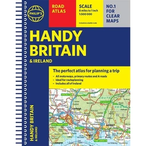
    Description: The perfect atlas for planning a trip anywhere in the UK and Ireland The essential handy road atlas for planning a trip in Britain and Ireland. Keep it in the glove box or your travel bag for quick and easy reference. This gem of a glove-box sized atlas has all the core information you need for driving around the British Isles. It includes all the motorways, primary roads and A Roads and they are clearly shown - ideal for route planning. There is a separate 4-page road map of Ireland for easy use. Alongside that, this handy atlas includes a key map, a distance table and useful counties map. All the towns and villages listed within are indexed and all the information comes in a handy glove-box size format with practical, lie-flat spiral binding. With the scale at a user-friendly 8 miles to 1 inch /1:500,000 (Ireland 19 miles to 1 inch /1:1,200,000) and fully up-to-date using Philip's clear mapping, you will never be at a loss to establish the best route. Keep in the car or sling in your bag before travelling, the Philip's Handy Road Atlas of Britain is also great value at only £5.99. Waterstones Philip's Handy Road Atlas Britain - shop the best deal online on thebookbug.co.uk

    Category: Books

    Delivery cost: 2.99

    ISBN: 9781849075770

     
    Waterstones logo

    Merchant: Waterstones

    Product ID: 9781849075770

     
  • Waterstones 2024 Philip's Big Easy to Read Britain Road Atlas

    Price: £14.99

    Brand: Waterstones


    Description: The detail you need at a size you can read. The latest 2024 Big Easy to Read Britain road atlas from Philip's with:- Large print maps - Huge 1:150,000 scale (approx 2.4 miles to 1 inch) - Large print place names - Large print index - Large format (nearly A3) - Super-clear 10-page routeplanner - 88 large town plans - 10 big city approach maps - Easy-to-use paperback binding At last, a Road Atlas that everyone can read easily in or out of the car, no matter what the conditions. Large scale maps, large print place names, clear road colours (which are easier to read in the dark), large print index and a special route-planning section that's almost a road atlas in itself. If it's dark, or you just can't find your glasses, the new Philip's Big Easy to Read Britain Road Atlas is the answer - wherever you're driving in England, Scotland or Wales. Waterstones 2024 Philip's Big Easy to Read Britain Road Atlas - shop the best deal online on thebookbug.co.uk

    Category: Books

    Delivery cost: 2.99

    ISBN: 9781849076258

     
    Waterstones logo

    Merchant: Waterstones

    Product ID: 9781849076258

     
  • Waterstones Great Britain A-Z Handy Road Atlas 2024 (A5 Spiral)

    Price: £8.99

    Brand: Waterstones


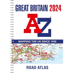
    Description: Navigate your way around Great Britain with this detailed and easy-to-use A-Z Road Atlas. A full-colour, spiral bound road atlas, now fully revised and updated. Clear detailed road mapping at a scale of 5 miles to 1 inch. Presented in a compact A5 size for ease of storage. Features include: Mileage chart Channel Tunnel terminus maps Index to cities, towns, villages, hamlets and major destinations Map reference information also in French and German Instantly recognisable and easy to use, the road mapping has been specifically tailored for the smaller scale featuring: clear standard road classification colours for easy identification, motorway junction symbols, under construction and proposed roads, primary route destinations, service areas, National and county boundaries, and a wide range of tourist and ancillary information, including Blue Flag Beaches. This A-Z Handy Road Atlas of Great Britain and Northern Ireland is the perfect choice for those wanting a compact spiral bound publication with A-Z quality road mapping. Waterstones Great Britain A-Z Handy Road Atlas 2024 (A5 Spiral) - shop the best deal online on thebookbug.co.uk

    Category: Books

    Delivery cost: 2.99

    ISBN: 9780008597634

     
    Waterstones logo

    Merchant: Waterstones

    Product ID: 9780008597634

     
  • Road Atlas Ireland, Sports, Hobbies & Travel, Paperback, Collins Maps

    Price: £6.99

    Brand: Collins


    Description: Explore Ireland with this accurate and fully updated road atlas. This road atlas is at A4 size, covering the whole of Ireland and features clear and detailed Collins colour mapping at a scale of 5.2 miles to 1 inch. Perfect for both residents and visitorstouring Ireland. Road Atlas Ireland, Sports, Hobbies & Travel, Paperback, Collins Maps - shop the best deal online on thebookbug.co.uk

    Category: Books

    Delivery cost: Spend £20 and get free shipping

    Dimensions: 210x297mm

    Keywords: Ireland,Irish books,city plans,Belfast map,Dublin map,Republic of Ireland ROI,Northern Ireland,Ireland Irish tourist guide,navigation,route finding,speed camera,speed enforcement zone,Bestselling Ireland road map,OS Ireland,Fold out map Ireland

    ISBN: 9780008597672

     
    Harper Collins logo

    Merchant: Harper Collins

    Product ID: 9780008597672

     
  • Geographers' A-Z Map Co Ltd Great Britain A-Z Road Atlas 2024 (A4 Spiral), Sports, Hobbies & Travel, Spiral Bound, A–Z maps

    Price: £12.99

    Brand: Geographers' A-Z Map Co Ltd


    Description: A spiral bound, full-colour road atlas, now fully revised and updated. Clear detailed road mapping at a mainland map scale of 3.5 miles to 1 inch. Published in an easy-to-read A4 size. Geographers' A-Z Map Co Ltd Great Britain A-Z Road Atlas 2024 (A4 Spiral), Sports, Hobbies & Travel, Spiral Bound, A–Z maps - shop the best deal online on thebookbug.co.uk

    Category: Books

    Delivery cost: Spend £20 and get free shipping

    Dimensions: 202x272mm

    Keywords: road atlas,google maps,atlas,route map,a to z maps,maps,street map,route planner uk,street finder,Sat Nav,GPS,aa maps,road map uk,satellite navigation

    ISBN: 9780008597641

     
    Harper Collins logo

    Merchant: Harper Collins

    Product ID: 9780008597641