Waterstones British Historic Towns Atlas Volume VII: Oxford

4.5 out of 5 stars
Waterstones British Historic Towns Atlas Volume VII: Oxford
Zoom
 
SCROLL DOWN
TO EXPLORE MORE
 

Price: £70.00

Brand: Waterstones


Description: The latest volume of the British Historic Towns Atlas series covers the internationally-renowned city of Oxford. Famed for its university and its many outstanding historic buildings, the volume presents in mapped form the history of its topographical development. From its prehistoric setting, through its contentious Anglo-Saxon foundation, the medieval establishment of its university, and its sporadic growth after that, the Atlas charts how it became a nineteenth-century city dominated by colleges, churches, university buildings, and its associated publishing industry. The Atlas is presented as a large-format portfolio containing a series of maps showing the city at key points in its history, many illustrations of its buildings and streets, maps to show its setting, and reproduction early maps of the city. A readable text introduces and explains the maps, giving the reader a thorough grounding in how and why Oxford developed, and an explanation of its changing fortunes. A supplementary chapter brings the situation up to date. Whilst many histories of the university have been written, the Atlas concentrates on the topographic development of Oxford as a settlement, and explains it in mapped form. A comprehensive gazetteer lists every building and street shown on the maps, with a short history and references for further reading. Waterstones British Historic Towns Atlas Volume VII: Oxford - shop the best deal online on thebookbug.co.uk


Category: Books

Merchant: Waterstones

Product ID: 9781789253269

Delivery cost: 0.00

ISBN: 9781789253269

 
Waterstones logo
 

My website utilises affiliate links when you click my 'Get the best deal now' buttons. If you buy something through one of these links, I may earn a little commission, at no extra cost to you.


I have relationships with many of the top online retailers (purchasing, shipping and returns will be handled directly by them) which enables me to offer the best deal online for the Waterstones British Historic Towns Atlas Volume VII: Oxford and many other similar products - which will appear below, to enhance your online shopping experience.


For even more great deals on Waterstones Books, click the link.


Author: Rob P.

Rating: 5

Review: Very consise and interesting Historical Atlas


Author: Rob P.

Rating: 5

Review: Very consise and interesting Historical Atlas


Similar Products

  • Waterstones Atlas & Jigsaw Great Britain & Ireland

    Price: £12.99

    Brand: Waterstones


    Description: Take a tour of the British Isles with this entertaining atlas and 300-piece jigsaw, with hundreds of animals, landmarks and attractions to spot. The sturdy box contains a vividly illustrated jigsaw of a map of Britain and Ireland, plus a picture atlas showing each region with towns and cities, rivers, flags and other details. (The Picture Atlas of Great Britain and Ireland is also available separately.). Waterstones Atlas & Jigsaw Great Britain & Ireland - shop the best deal online on thebookbug.co.uk

    Category: Books

    Delivery cost: 2.99

    ISBN: 9781805318927

     
    Waterstones logo

    Merchant: Waterstones

    Product ID: 9781805318927

     
  • Waterstones Oxford Student Atlas 2012

    Price: £15.99

    Brand: Waterstones


    Description: The Oxford Student Atlas includes stunning satellite images, country data, and easy-to-read colourful mapping, presented in an accessible visual layout based on research into how students use maps. The atlas covers key exam specification themes and issues such as earthquakes and volcanoes, climate and climate change, economic activity, development, and globalisation. It includes comprehensive coverage of the British Isles, Europe, and the world. It is the ideal atlas for students to use on exam courses. Waterstones Oxford Student Atlas 2012 - shop the best deal online on thebookbug.co.uk

    Category: Books

    Delivery cost: 2.99

    ISBN: 9780199136995

     
    Waterstones logo

    Merchant: Waterstones

    Product ID: 9780199136995

     
  • Waterstones Drogheda

    Price: £30.00

    Brand: Waterstones


    Description: Drogheda, the twenty-ninth in the IHTA series, will bring this important Irish settlement into the Irish and European Historic Towns Atlas scheme where it can be compared with towns across Ireland and over 500 in Europe. Drogheda has a rich and varied history that has been carefully compiled by author Ned Mc Hugh who has trawled hundreds of sources to generate histories of thousands of topographic sites in Drogheda. An essay with thematic maps fleshes out the topographical history into the development of the town. IHTA no. 29 will be reproduced in large format with many historic and modern maps and illustrations in loose sheets to accompany the detailed text section.

    Category: Books

    Delivery cost: 0.00

    ISBN: 9781908997746

     
    Waterstones logo

    Merchant: Waterstones

    Product ID: 9781908997746

     
  • Waterstones Oxford Student Atlas

    Price: £15.99

    Brand: Waterstones


    Description: The Oxford Student Atlas includes stunning satellite images, country data, and easy-to-read colourful mapping, presented in an accessible visual layout based on research into how students use maps. The atlas covers key exam specification themes and issues such as earthquakes and volcanoes, climate and climate change, economic activity, development, and globalisation. It includes comprehensive coverage of the British Isles, Europe, and the world. It is the ideal atlas for students to use on exam courses.

    Category: Books

    Delivery cost: 2.99

    ISBN: 9780199136988

     
    Waterstones logo

    Merchant: Waterstones

    Product ID: 9780199136988

     
  • Waterstones Oxford School Atlas

    Price: £11.99

    Brand: Waterstones

     
    4.6 out of 5 stars

    62 ratings


    Description: The Oxford School Atlas includes country data and easy-to-read colourful mapping, presented in an accessible visual layout based on research into how students use maps. The atlas covers key curriculum themes such as earthquakes and volcanoes, climate, economic activity, and development. It includes comprehensive coverage of the British Isles, and case studies of Italy, Kenya, Brazil, Japan, China, California, the Indian Ocean tsunami, Hurricane Katrina, and Antarctica.

    Category: Books

    Delivery cost: 2.99

    ISBN: 9780199137022

     
    Waterstones logo

    Merchant: Waterstones

    Product ID: 9780199137022

     
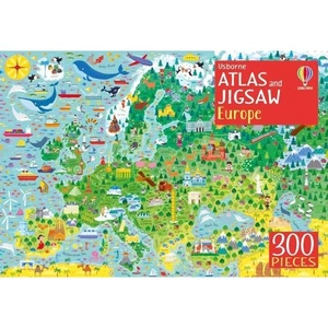
  • Waterstones Usborne Atlas and Jigsaw Europe

    Price: £9.99

    Brand: Waterstones

     
    4.7 out of 5 stars

    98 ratings


    Description: Take a tour of Europe with this entertaining picture atlas and 300-piece jigsaw, with hundreds of animals, landmarks and attractions to spot. The sturdy box contains a vividly illustrated jigsaw of a map of Europe, plus a 32-page atlas showing each country with towns and cities, rivers, flags and other details, and internet links to find out more. (The picture atlas is also available as a hardback book called Picture Atlas of Europe.). Waterstones Usborne Atlas and Jigsaw Europe - shop the best deal online on thebookbug.co.uk

    Category: Books

    Delivery cost: 2.99

    ISBN: 9781474948067

     
    Waterstones logo

    Merchant: Waterstones

    Product ID: 9781474948067

     
  • Waterstones Historic Oxford

    Price: £22.50

    Brand: Waterstones


    Description: Lively and authoritative account of Oxford's historic background. Waterstones Historic Oxford - shop the best deal online on thebookbug.co.uk

    Category: Books

    Delivery cost: 2.99

    ISBN: 9780752431505

     
    Waterstones logo

    Merchant: Waterstones

    Product ID: 9780752431505

     
  • Waterstones Nairn's Towns

    Price: £8.99

    Brand: Waterstones


    Description: In this new paperback edition of Britain's Changing Towns (1967), introduced, edited and updated by Owen Hatherley in 2013 these essays show Nairn writing about cities and towns as wholes rather than as collections of individual buildings. In each of them, there are several things happening at once - assessments of historic townscape, capsule reviews of new buildings, attempts to find the specific character of each place. Hatherley can dish it out with the best of Nairn when it comes to detailing the dreadful regeneration programmes, empty civic boosterism, shoddy shopping malls, PFI hospitals, and cheap volume house-building schemes which have continued to blight these towns and cities since the 1960s, which Nairn presciently anticipated. Waterstones Nairn's Towns - shop the best deal online on thebookbug.co.uk

    Category: Books

    Delivery cost: 2.99

    ISBN: 9781910749289

     
    Waterstones logo

    Merchant: Waterstones

    Product ID: 9781910749289

     
  • Waterstones Oxford Very First Atlas

    Price: £6.99

    Brand: Waterstones

     
    4.4 out of 5 stars

    50 ratings


    Description: Have you ever wondered:· What the Earth looks like from space?· How many continents there are?· Where Mount Everest is? Find out in your very first atlas! The Oxford Very First Atlas is a stimulating first atlas for young children. It is completely up-to-date with accurate, easy-to-read and colourful mapping, presented in an accessible visual layout based on research into how young children use maps. It introduces young learners to maps and develops early atlas skills, encouraging them to talk about local and distant places and to find key places on maps. It includes:· An introduction to the globe and places around the world· Stunning images of the Earth from space· Clear and colourful maps of the world and all the continents. The Oxford Very First Atlas is also accompanied by an Activity Book for independent work to develop map skills and an e-Atlas CD-ROM providing an interactive version of the atlas for whole-class display.

    Category: Books

    Delivery cost: 2.99

    ISBN: 9780198487869

     
    Waterstones logo

    Merchant: Waterstones

    Product ID: 9780198487869

     
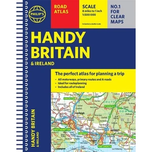
  • Waterstones Philip's Handy Road Atlas Britain

    Price: £5.99

    Brand: Waterstones


    Description: The perfect atlas for planning a trip anywhere in the UK and Ireland The essential handy road atlas for planning a trip in Britain and Ireland. Keep it in the glove box or your travel bag for quick and easy reference. This gem of a glove-box sized atlas has all the core information you need for driving around the British Isles. It includes all the motorways, primary roads and A Roads and they are clearly shown - ideal for route planning. There is a separate 4-page road map of Ireland for easy use. Alongside that, this handy atlas includes a key map, a distance table and useful counties map. All the towns and villages listed within are indexed and all the information comes in a handy glove-box size format with practical, lie-flat spiral binding. With the scale at a user-friendly 8 miles to 1 inch /1:500,000 (Ireland 19 miles to 1 inch /1:1,200,000) and fully up-to-date using Philip's clear mapping, you will never be at a loss to establish the best route. Keep in the car or sling in your bag before travelling, the Philip's Handy Road Atlas of Britain is also great value at only £5.99. Waterstones Philip's Handy Road Atlas Britain - shop the best deal online on thebookbug.co.uk

    Category: Books

    Delivery cost: 2.99

    ISBN: 9781849075770

     
    Waterstones logo

    Merchant: Waterstones

    Product ID: 9781849075770