Scholastic Oxford Very First Atlas x 30

Scholastic Oxford Very First Atlas x 30
Zoom
Currently out of stock
 
SCROLL DOWN
TO EXPLORE MORE
 

Price: £167.00

Brand: Scholastic


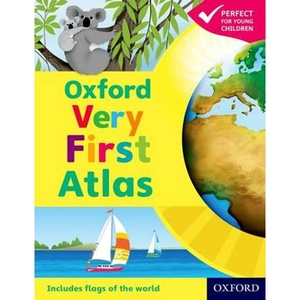
Description: Hey, little globetrotters! Explore your big planet in fun facts, colour art and simple maps. This book might be for small people, but it's full of BIG facts about your planet. Have you ever wondered what Earth looks like from space? How many continents there are? Where Mount Everest is? Now you can find out. There are lots of places in the world. But just one place you need to look to discover them all: this book. Mapping made simple for the very youngest learners Beautifully colourful book made with Oxford quality Stunning satellite photos and detailed maps galore Lots of fascinating facts about people and places Supplied as a pack of 30 copies. #sum-18-ie. Scholastic Oxford Very First Atlas x 30 - shop the best deal online on thebookbug.co.uk


Category: Books

Merchant: Scholastic

Product ID: 115737

ISBN: 9789999617147

 
Scholastic logo
 
Currently out of stock
 

Similar Products

  • Waterstones Oxford Very First Atlas

    Price: £6.99

    Brand: Waterstones

     
    4.4 out of 5 stars

    50 ratings


    Description: Have you ever wondered:· What the Earth looks like from space?· How many continents there are?· Where Mount Everest is? Find out in your very first atlas! The Oxford Very First Atlas is a stimulating first atlas for young children. It is completely up-to-date with accurate, easy-to-read and colourful mapping, presented in an accessible visual layout based on research into how young children use maps. It introduces young learners to maps and develops early atlas skills, encouraging them to talk about local and distant places and to find key places on maps. It includes:· An introduction to the globe and places around the world· Stunning images of the Earth from space· Clear and colourful maps of the world and all the continents. The Oxford Very First Atlas is also accompanied by an Activity Book for independent work to develop map skills and an e-Atlas CD-ROM providing an interactive version of the atlas for whole-class display.

    Category: Books

    Delivery cost: 2.99

    ISBN: 9780198487869

     
    Waterstones logo

    Merchant: Waterstones

    Product ID: 9780198487869

     
  • Waterstones Oxford Student Atlas 2012

    Price: £15.99

    Brand: Waterstones


    Description: The Oxford Student Atlas includes stunning satellite images, country data, and easy-to-read colourful mapping, presented in an accessible visual layout based on research into how students use maps. The atlas covers key exam specification themes and issues such as earthquakes and volcanoes, climate and climate change, economic activity, development, and globalisation. It includes comprehensive coverage of the British Isles, Europe, and the world. It is the ideal atlas for students to use on exam courses. Waterstones Oxford Student Atlas 2012 - shop the best deal online on thebookbug.co.uk

    Category: Books

    Delivery cost: 2.99

    ISBN: 9780199136995

     
    Waterstones logo

    Merchant: Waterstones

    Product ID: 9780199136995

     
  • Waterstones Oxford First Atlas

    Price: £9.99

    Brand: Waterstones


    Description: The Oxford First Atlas is an accessible and informative atlas for young learners in their first years at school. It is completely up-to-date, and features accurate and easy-to-read colourful mapping presented in an accessible visual layout based on research into how young children use maps. It encourages children to learn about their world and develop atlas and map skills. It includes:· A simple introduction to Planet Earth and places around the world· Clear and colourful maps of the world and all the continents· Clear and colourful thematic maps showing coasts, rivers, mountains, the weather, environments, cities, animals, and holidays · Colourful photographs· Fascinating facts about places and people· Questions that encourage children to think and engage with the maps The Oxford First Atlas is accompanied by a Teacher's Handbook for practical page-by-page guidance on using the atlas, an Activity Book for independent work to develop map skills, and an e-Atlas CD-ROM providing an interactive version of the atlas for whole-class display.

    Category: Books

    Delivery cost: 2.99

    ISBN: 9780198487845

     
    Waterstones logo

    Merchant: Waterstones

    Product ID: 9780198487845

     
  • Waterstones Oxford Student Atlas

    Price: £15.99

    Brand: Waterstones


    Description: The Oxford Student Atlas includes stunning satellite images, country data, and easy-to-read colourful mapping, presented in an accessible visual layout based on research into how students use maps. The atlas covers key exam specification themes and issues such as earthquakes and volcanoes, climate and climate change, economic activity, development, and globalisation. It includes comprehensive coverage of the British Isles, Europe, and the world. It is the ideal atlas for students to use on exam courses.

    Category: Books

    Delivery cost: 2.99

    ISBN: 9780199136988

     
    Waterstones logo

    Merchant: Waterstones

    Product ID: 9780199136988

     
  • Lovereading Oxford Bible Atlas

    Price: £14.39

    Brand: Lovereading


    Description: Oxford Bible Atlas. Paperback /softback. By Adrian (Senior Lecturer in Hebrew Bible, the University of Manchester) Curtis.

    Category: Books

     
    LoveReading logo

    Merchant: LoveReading

    Product ID: 9780199560462

     
  • Waterstones Oxford Primary Atlas

    Price: £10.99

    Brand: Waterstones

     
    4.5 out of 5 stars

    54 ratings


    Description: The Oxford Primary Atlas is a clear, bright and informative atlas for all 7-11 year olds. This new edition includes up-to-date country data and easy-to-read colourful mapping, presented in an accessible visual layout based on research into how young children use maps. It features key curriculum themes such as landscapes, water, settlements, connections, and environments. It includes easy-to-use features such as learning statements to summarize each theme, focus panels to prompt independent or group enquiry, innovative grid codes to help children find places listed in the index, colourful photographs to aid children's understanding of map symbols, attractive artwork to provide a 'sense of place', and stimulating graphics to make large numbers easy to understand. This new edition of the Oxford Primary Atlas, specially written to support the requirements of primary geography at Key Stage 2, and incorporating the most popular features of the bestselling Oxford Junior Atlas, uses simple, clear mapping and colourful illustration to create a stimulating and informative atlas for all 7-11 year olds. The Oxford Primary Atlas is also accompanied by the Activity Book for independent work to develop map literacy skills, and the e-Atlas CD-ROM for whole class display on interactive whiteboard.

    Category: Books

    Delivery cost: 2.99

    ISBN: 9780198480174

     
    Waterstones logo

    Merchant: Waterstones

    Product ID: 9780198480174

     
  • Waterstones Oxford School Atlas

    Price: £11.99

    Brand: Waterstones

     
    4.6 out of 5 stars

    62 ratings


    Description: The Oxford School Atlas includes country data and easy-to-read colourful mapping, presented in an accessible visual layout based on research into how students use maps. The atlas covers key curriculum themes such as earthquakes and volcanoes, climate, economic activity, and development. It includes comprehensive coverage of the British Isles, and case studies of Italy, Kenya, Brazil, Japan, China, California, the Indian Ocean tsunami, Hurricane Katrina, and Antarctica.

    Category: Books

    Delivery cost: 2.99

    ISBN: 9780199137022

     
    Waterstones logo

    Merchant: Waterstones

    Product ID: 9780199137022

     
  • Waterstones British Historic Towns Atlas Volume VII: Oxford

    Price: £70.00

    Brand: Waterstones

     
    4.5 out of 5 stars

    2 ratings


    Description: The latest volume of the British Historic Towns Atlas series covers the internationally-renowned city of Oxford. Famed for its university and its many outstanding historic buildings, the volume presents in mapped form the history of its topographical development. From its prehistoric setting, through its contentious Anglo-Saxon foundation, the medieval establishment of its university, and its sporadic growth after that, the Atlas charts how it became a nineteenth-century city dominated by colleges, churches, university buildings, and its associated publishing industry. The Atlas is presented as a large-format portfolio containing a series of maps showing the city at key points in its history, many illustrations of its buildings and streets, maps to show its setting, and reproduction early maps of the city. A readable text introduces and explains the maps, giving the reader a thorough grounding in how and why Oxford developed, and an explanation of its changing fortunes. A supplementary chapter brings the situation up to date. Whilst many histories of the university have been written, the Atlas concentrates on the topographic development of Oxford as a settlement, and explains it in mapped form. A comprehensive gazetteer lists every building and street shown on the maps, with a short history and references for further reading. Waterstones British Historic Towns Atlas Volume VII: Oxford - shop the best deal online on thebookbug.co.uk

    Category: Books

    Delivery cost: 0.00

    ISBN: 9781789253269

     
    Waterstones logo

    Merchant: Waterstones

    Product ID: 9781789253269

     
  • Waterstones Usborne Atlas and Jigsaw Europe

    Price: £9.99

    Brand: Waterstones

     
    4.7 out of 5 stars

    98 ratings


    Description: Take a tour of Europe with this entertaining picture atlas and 300-piece jigsaw, with hundreds of animals, landmarks and attractions to spot. The sturdy box contains a vividly illustrated jigsaw of a map of Europe, plus a 32-page atlas showing each country with towns and cities, rivers, flags and other details, and internet links to find out more. (The picture atlas is also available as a hardback book called Picture Atlas of Europe.). Waterstones Usborne Atlas and Jigsaw Europe - shop the best deal online on thebookbug.co.uk

    Category: Books

    Delivery cost: 2.99

    ISBN: 9781474948067

     
    Waterstones logo

    Merchant: Waterstones

    Product ID: 9781474948067

     
  • Waterstones Collins First Atlas

    Price: £5.99

    Brand: Waterstones

     
    4.6 out of 5 stars

    537 ratings


    Description: The must-have atlas for children aged 4-7 Collins First Atlas is a fun, vibrant and clear starter atlas for children aged 4-7 years, providing the perfect foundation to basic geography skills. The atlas begins by introducing pupils to photographs and mapping of a local area, then gradually leads them through maps of regional, national, continental and global areas. Short, informative sentences introduce pupils to basic geographical and atlas vocabulary Maps are clearly labelled to highlight certain countries and features Mapping concepts are presented in a way that supports learning development, as concepts become more complex Ideal for classroom use or home learning Fully up-to-date Suitable for EYFS and KS1 This atlas is also available in a Kindle format. The next atlas in this series is the Collins Primary Atlas, suitable for ages 7+ and KS2.

    Category: Books

    Delivery cost: 2.99

    ISBN: 9780008485931

     
    Waterstones logo

    Merchant: Waterstones

    Product ID: 9780008485931